How Charlotte’s Geographic Approach Improved Public Services
Charlotte, North Carolina’s public water and wastewater department created an intelligent utility system with GIS technology.


Charlotte, North Carolina’s public water and wastewater department created an intelligent utility system with GIS technology.
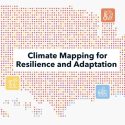
At the center of the new Climate Mapping for Resilience and Adaptation portal is a tool that features data relevant to making decisions and projections about climate conditions that can be searched by address to help communities adapt.
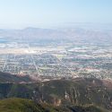
San Bernardino County’s Department of Public Health used GIS technology to adapt to new challenges and better serve the community.

When the city of Reno launched initiatives to expand its economy and offset pandemic-related tourism declines, it relied on new technology: geographic information systems (GIS). Here’s what GIS do — and what lessons Reno has to share.
In Atlanta, one nonprofit is using geographic tools help locate and analyze often overlooked land within and alongside highways as sites for solar panel arrays.

Residents in Ontario, California, are poised to be among the first in the U.S. to experience a citywide drone delivery program.

Seattle implemented a unique strategy to expand housing choices—relying on a new, interactive mapping website to guide consumers.

Montana’s Department of Natural Resources and Conservation employed maps and dashboards to add transparency to the distribution of economic stimulus funds.

Maricopa County needed to identify the most vulnerable areas in the county and promote optimal vaccination sites to the public.

The city of Modesto, California used mobile apps powered by geospatial technology to identify homeless populations and improve outreach and services.
Notifications