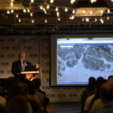
Using Maps to Drive Better Decisions
Learn how to get the most out of your imagery with Esri’s imagery analysis solutions.


Learn how to get the most out of your imagery with Esri’s imagery analysis solutions.

I would argue that one of the most interesting reasons this election will be viewed as a tipping point is because of the role of technology in making voters’ experiences even better.
Imagery analysis methods like change detection help provide critical data for environmental monitoring and natural resource management. Beach erosion, melting ice caps and forest fires are a few examples of the types of change detection analysis that imagery can support.

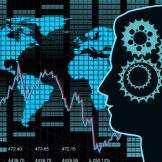
We see the explosion of GIS with the advancements in technology. Do you know how often you use GIS?

Leveraging mobile technology can do everything from making your agency’s workforce more efficient to promoting citizen engagement. Check out these tools that can help your agency refine its mobile strategy and implement more efficient and effective processes.

Keeping constituents and the communities they live in safe is a top priority for law makers. Fortunately, open data is making this a little easier. Learn how govies are forming partnerships at the state, local, and federal levels to optimize open data and keep communities safe.

GIS technology can be used to help address fraud, waste and abuse in several different ways. Organizations benefit from closely examining location-based factors to identify hot spots, regional variations and clusters, such as co-locations of services. Then, real-time data analysis shows spatial trends that inform predictions about future needs and issues — or, in this… Read more »
Learn how Esri is helping to optimize the information in huge datasets to visualize the data and make it much more useful to you and your agency.

Today, most government agencies have to deal with new data sources that are coming to them almost daily – social media, open data, sensor data, military intelligence or data from a sister agency. And the biggest challenge? Currently, the constant stream of data the government is receiving doesn’t fit in current geospatial tools.

The rise of open data has seen many agencies hopping on the bandwagon and working towards open data policies. However, there is still frequently confusion over how an agency can best utilize their data to meet both internal and public needs.