Put Your Big Data to Good Use Instantly
Learn how Esri is helping to optimize the information in huge datasets to visualize the data and make it much more useful to you and your agency.


Learn how Esri is helping to optimize the information in huge datasets to visualize the data and make it much more useful to you and your agency.

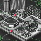
Today, most government agencies have to deal with new data sources that are coming to them almost daily – social media, open data, sensor data, military intelligence or data from a sister agency. And the biggest challenge? Currently, the constant stream of data the government is receiving doesn’t fit in current geospatial tools.

The rise of open data has seen many agencies hopping on the bandwagon and working towards open data policies. However, there is still frequently confusion over how an agency can best utilize their data to meet both internal and public needs.
Learn how GIS technology is working with healthcare to transform communities.

Your GIS elevator pitch.

Data analytics is changing the way governments make decisions. But while the benefits of data analytics have often been touted, it can still be difficult to know how to incorporate data into your agency operations and what to look for in analytics tools.
As government is changing, new opportunities for innovation and development are opening up. Here are my top 10 areas for innovation that I highlighted in a recent presentation at the Esri Public Sector CIO Summit in California.

Geography, the science of our world, coupled with geographic information systems (GIS) helps us understand the Earth. We can apply this geographic knowledge to a host of human activities. Last night, we learned how to expand our domain expertise into the world of scientific data management, modeling and analysis. Science practitioners and GIS professionals came togetherRead… Read more »

Esri’s Federal GIS Conference is only one week away! Held in Washington, D.C. on February 24th and 25th, 2016 at the Walter E. Washington Convention Center, federal employees will gather to learn how GIS can advance mission goals and to network with GIS leaders. The next day, February 26th, geospatial developers will have the chanceRead… Read more »

Esri’s Federal GIS Conference in Washington, D.C., a two-day event focused on how federal government employees can GIS technology to achieve mission goals, is just weeks away. But while the FedGIS Conference ends on February 25th, the learning opportunities for geospatial developers continue with the Esri DevSummit DC on Friday, February 26th, also at theRead… Read more »