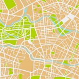
GIS

GIS: Your Platform for a Resilient Community

In our latest Industry Perspective, we explore what it means to be a resilient community, and how you can lead the charge to build a foundation for stronger communities. Our report will define what it means to be a resilient community; feature case studies of five communities who have adopted resiliency strategies; and provide insightsRead… Read more »

Using Geography to Fight Food Insecurity

It is a critical time for global food systems. Strained by population growth and the unpredictable threats of climate change, the food security of billions worldwide is under threat. To meet this challenge, Esri, the global leader in GIS technology, is unleashing the power of geography to strengthen food resilience for a more sustainable future.Read… Read more »

How Your Cellphone Can Halt Ebola

Think about the computing power within your pocket: you can find the closest jumbo slice, order an Uber ride home and…track and target diseases? That’s right. Geographic Information Systems (GIS) – the same technology that powers maps on your smartphone – can be used to help medical providers map the spread of diseases like EbolaRead… Read more »

Keep Your City Running with Data and GIS

There are some basic features—things like buildings, water systems, parks, roads, electrical lines and buildings—that comprise the infrastructure of any city. And many people, myself included, often think of these as static features within the city landscape. However, if you work in state or local government, you know that’s not the case. The infrastructure ofRead… Read more »

Only GIS Can Prevent Forest Fires

Esri and GovLoop recently hosted a meetup showcasing how GIS solutions can make it easier than ever before to create online mapping applications. Featured at the event was a case study from Global Forest Watch, which is “a new dynamic online forest monitoring and alert system, designed to empower people everywhere to better manage forests.Read… Read more »

GovLoop Training: Mapping for Policy Makers

As a lifetime member of Girl Scouts of the U.S.A.®, I have earned my fair share of compass merit badges. Despite my badge-certified sense of direction, I still have trouble locating some places when doing a simple Internet search, especially after I have moved to a new city. With ArcGIS, mapping data in an organized,Read… Read more »

Highlighting the Power of GIS for Government

Through spatial analysis, we are able to find clarity from complexity, and tackle some of societies most pressing challenges. GovLoop and Esri have partnered to create a series of videos showing how GIS is transforming our world. Below you’ll find 4 great government case studies using GIS, and 6 startups powered by Esri that areRead… Read more »