Many people are probably familiar with Google Maps. This online tool offered by Google allows you to see an aerial view of a specific area and get directions and travel times from one address to another. Some might also take advantage of Google’s “street view” which allows you to see a location as if you were standing there looking down the street. Of course, this is only available if Google has added street view capability to the roadway – in some cities it is still only accessible along major roads. But because we now have street view available on all the roads in our city, I’ve been using it quite a bit at work – it’s a quick and easy way to check out features along a road. But the other day I discovered another very useful capability hidden within all that Google goodness and thought I’d share it in case someone else was like me and didn’t realize it was there.
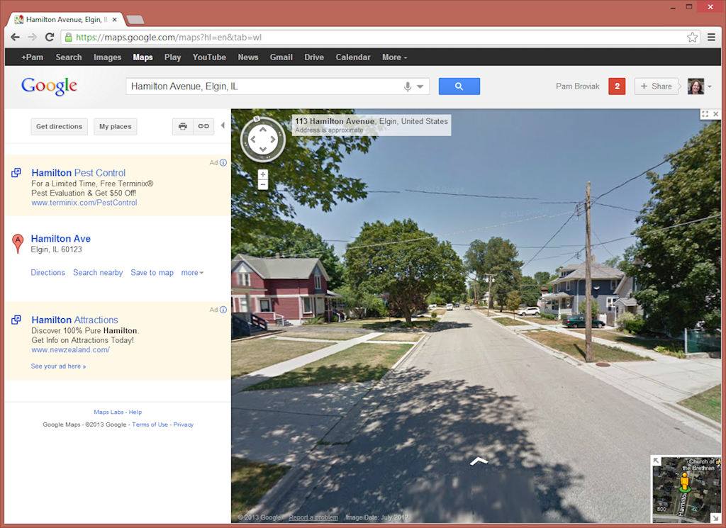
I was preparing a submittal for a project to be reviewed by a state agency and needed some photos of the street where the project was located. For this particular submittal all I needed was a general photo of the street that would show it was a typical asphalt roadway in a residential area. At first I looked to see if there was one available on the computer, but no luck. Just as I was wondering about having to go out and take some photos, I thought about using street view to see if that image would work. So I went into Google maps and dragged the little orange guy down from the upper left of the map to the road where I needed the photo. It was the perfect photo for my purpose. Using an example of an address in a neighboring city, I figured I would walk you through what I did and what I found. Here’s how it looks when you zoom down to street view:
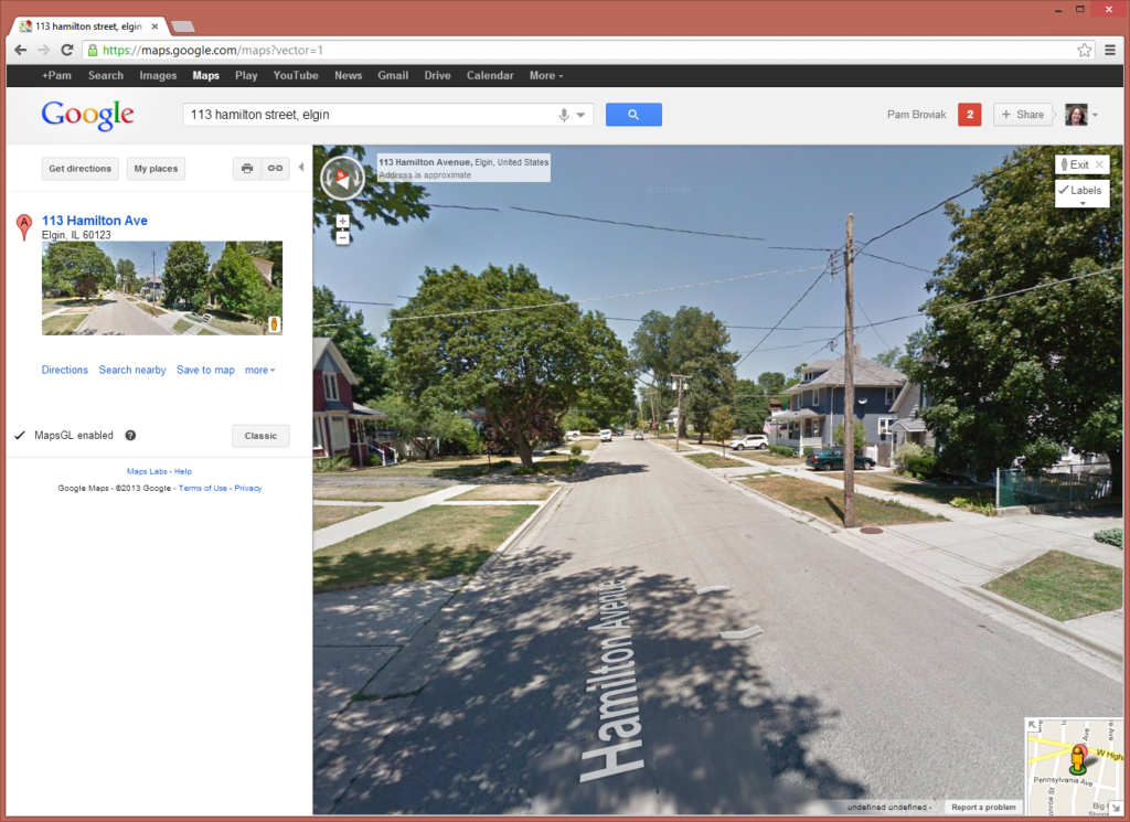
Now, that’s a nice simple image that shows perfectly the type of image I needed to submit to this agency. I also noticed that Google offers an updated version of Google Maps called MapsGL so I switched over to that to try it out. You can see the difference below. One nice addition is the road name displayed on the roadway:
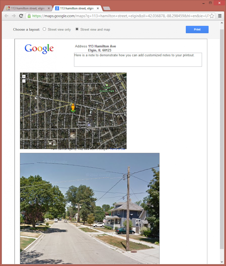
So just as I was trying to decide what program to paste this screenshot into for preparing an exhibit for the submittal, I noticed the print button. I figured let’s see what it looks like – maybe I can get away with just using that. So I clicked the little printer icon and the following page was created.
Wow – I thought, that looks pretty good. Google already has set it up on the page in a professional enough looking manner that I can just use that. They show the location and even offer the ability to type my own note and add any information the agency might need. (As an aside, I also noticed it looks like the latitude and longitude are displayed in the URL so if you needed that in the note, you could also copy and paste it from the URL.) But just as I was getting ready to print this from my browser, I noticed something else – Google offers another display option that includes the street view and a map. So I clicked the little button at the top of this page next to “Street view and map” and got the following:
How can you get better than that?! I have the perfect photo and a map all displayed in a simple and nice manner on a page that is all ready to print out by hitting that blue print button. Can it get any easier than that!? Maybe it seems silly to get so excited over something so simple, but for me, this saves the time it takes to go take a photo, download it to the computer, get it into a program, and create an exhibit. Sure it’s not hard or difficult, but it does take time. I figured Google saved me at least a couple hours of my time the other day since I had four locations where I had to get this information. Doing it in this manner took only five minutes, and I have to admit, with the map, looks better and more professional than any of the past exhibits I have made for this same purpose.
Go Google! Making us better engineers one little app at a time!


Very cool …
Google collects many other data when collecting street views. Is anyone aware of how and with whom they are shared and how others can get access?