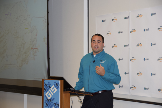
Scott Cecilio, Esri solution engineer, speaking at the GovLoop and Esri Meetup
Cybersecurity professionals face an unprecedented challenge as our world has become more connected. Although this connectivity has streamlined communications and helped us connect easier than ever before, we are also exposed to increased risk. To help address these issues, GovLoop and Esri hosted an event last Thursday to discuss the importance of tying location to cybersecurity efforts.
With agencies creating more data than ever, and moving more and more services to the web, taking a proactive approach to cybersecurity is mission critical. To truly make your agency more resistant to cyberattacks, you need to understand location.
With GIS, organizations can leverage location data in ways to better anticipate, detect, respond and recover from cyberattacks. At the event, Esri cyber lead Ken Stoni discussed re-conceptualizing cyberspace as dataflows and implementing the concept in GIS software. This could allow organizations to create smart segmentation, in which data could be applied to improve responses to cyberthreats and attacks. “Geography matters, and the GIS capabilities are there to combat cyberthreats,” said Stoni.
GIS can provide agencies with real-time network visualizations and improved situational awareness. “We are taking tools and techniques that you are already familiar with, but just applying geospatial technology,” said Stoni. “We are looking at using data to make decisions, intervention, hardening or mediation; we are just looking to find those insights better.”
The event also included a presentation from Brandon Hoffman, Federal CTO of RedSeal Networks. Founded in 2004, RedSeal uses the topology and the results of vulnerability scanning software to determine the reach of each compromised host. This allows computer security teams to organize their work based on the damage that could be caused by each compromised host; it’s a risk-based approach to resource prioritization. (You can download his presentation here).
“Your mission needs a map – not just a geographic map, but a logical map: what does the network look like? How are they connected? How do they talk with each other?” said Brandon Hoffman. “When we talk about cyber prevention we are talking about the basics of cyber, you can’t control what you can’t see.”
Being able to see connections, traffic patterns and spot vulnerabilities are all essential to reducing your cybersecurity risks.
The final presentation was from Esri solution engineer, Scott Cecilio. He demoed a prototype cyber common operational picture built from the Esri and RedSeal technologies. The demonstration highlighted how the geospatial approach can enhance traditional IT decision-making.
- For more information on cybersecurity and GIS, check out the report, The Geospatial Approach to Cybersecurity: An Executive Overview.
- More great resources here, including a demo, slides and more information on GIS and cybersecurity.
Event sponsored by:
 When
Esri was founded in 1969, it realized even then that geographic information system (GIS) technology could make a difference in society. GIS helps people to solve problems at local, regional, national, and global scales. Access maps and apps at ArcGIS.com. Be sure to check out all the
GIS resources produced by Esri and GovLoop.


Leave a Reply
You must be logged in to post a comment.